
Remembering a unique railway – the Weston, Clevedon & Portishead.
We are the only group dedicated solely to this railway.


Copyright © 2009-2026 WC&P Railway Group

|
Maps: Alan Godfrey Old Ordnance Survey |
|
|
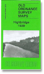
Sheet 38.03 - Highbridge 1929 This detailed map is double-sided to provide maximum coverage, with a large section of adjacent sheet 38.04 on the reverse. Most of the town of Highbridge is included and major features include the town centre, Newtown, St John's church, Bacon Factory, Saw Mills, Highbridge Wharf, Patent Fuel Works, Apex Brick & Tile Works, Alstone, River Brue, Clyce Wharf, extending west to the point where the Brue enters the River Parrett. The backing map covers the east of the town, including railway station, Highbridge Junction, the Somerset & Dorset Locomotive & Carriage Works, Walrow Terrace, Bristol Bridge Brick Works. Coverage extends east to Hook Rhyne and Isleport Road. The detailed portrayal of the railway works will be of especial interest to transport historians. Introduction by Tony Painter. Note that this map does not include the WC&PR. Approx. 15 inches to a mile scale. Price is £3.00 plus postage & packing CODE: MAP3803 (RRP is £3.50) See also Map 279 Weston-super-Mare & Highbridge 1897 (1 inch) |
|

Map: Highbridge 1929

£3.00
NEW