
Remembering a unique railway – the Weston, Clevedon & Portishead.
We are the only group dedicated solely to this railway.


Copyright © 2009-2026 WC&P Railway Group

|
Maps: Alan Godfrey Old Ordnance Survey |
|
|
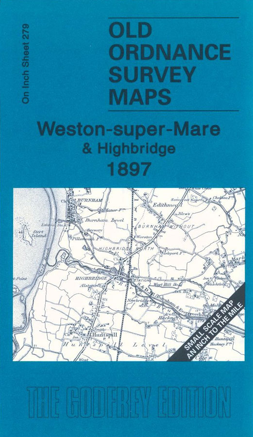
One Inch Sheet 279 – Weston-super-Mare & Highbridge 1897 This One Inch to the Mile map covers part of Somerset, with coverage extending from Weston-super-Mare southward to Highbridge and Kilve. Features include Burnham, Highbridge, Berrow Flats, Stert Flats, Steep Holme, the GWR, part of the Somerset & Dorset railway, and a small section of the WC&PR. On the reverse is a large scale map of the village of Huntspill. Other towns and villages included: Berrow, Bleadon, Brent Knoll, Burnham, East Brent, Highbridge, Huntspill, Hutton, Kilton, Kilve, Locking, Lympsham, Stockland Bristol, Uphill, Weston-super-Mare. Price is £3 plus postage & packing CODE: MAP279 (RRP is £3.50) Also see map 38.03 Highbridge 1929 (Large scale series) |
|

Map: Weston-super-Mare & Highbridge 1897

£3.00
Low stock on this item